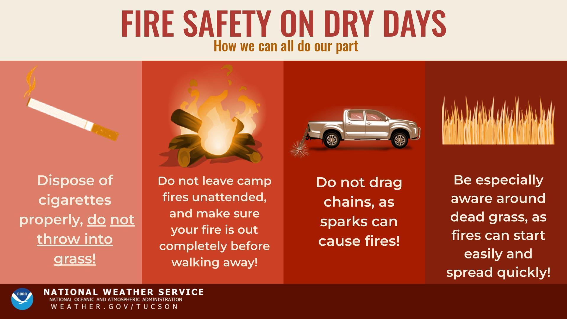
673
FXUS65 KTWC 200914
AFDTWC

Area Forecast Discussion
National Weather Service Tucson AZ
214 AM MST Sat Jun 20 2026

.SYNOPSIS...A dry forecast is in place into the middle of next
week. Temperatures remain around normal through the weekend
before rising several degrees above normal next week resulting
in moderate to major HeatRisk.

&&

.DISCUSSION...Broad high pressure exits over the Southwest and
northwest Mexico with the main storm track staying to the north
over the next week. Through the weekend the high stays centered
over Sonora leading to temperatures around normal or a degree
or two above normal. Early in the week to mid-week ensembles
show the high moving a little further north over southeast
Arizona or southern New Mexico, which will increase
temperatures. Expect highs during the work week to be 4-8
degrees above normal with Tucson NBM probabilities of 105 or
greater at 50-85 percent. This will lead to areas of Major
HeatRisk in the Tucson metro area and lower elevations of Graham
and Greenlee Counties. Elsewhere HEatRisk will be moderate.
Winds will be gusty out of the west/northwest each afternoon due
to daytime momentum transfer with the strongest winds expected
in Graham and Greenlee Counties. Expect elevated fire weather
conditions each afternoon in the Gila River Valley.

Also, depending on where exactly the center of the high sets up
early next week moisture could make its way into parts of
southeast Arizona Tuesday into Wednesday. Deterministic runs of
the GFS and Euro show the high center east of the CWA in
southern New Mexico. This would put southeast Arizona under
southerly mid-level flow, which could allow some moisture to
advect in. Not expecting much storm activity if the moisture
does make it into southeast Arizona, but the NBM does have
slight chance PoPs along the international border and White
Mountains Wednesday and Thursday. However its looking like this
moisture intrusion would be short-lived. The ridge gets pushed
south again as a trough enters the Pacific Northwest late in the
week into the weekend putting southeast Arizona under dry
westerly flow again.

&&

.AVIATION...Valid through 21/12Z.
SKC through the period for most locations with the exception
being southeast Cochise County, which could see FEW clouds
10k-14k ft AGL this afternoon. Surface winds west to southwest
at 8-16 kts with gusts to 20 kts, stronger at KSAD with
northwest winds and gusts to 25 kts. Winds will start tapering
off after 21/03Z. Aviation discussion not updated for TAF
amendments.

&&

.FIRE WEATHER...Winds will remain west/northwest through this
week with speeds of 10-15 mph and gusts to 25 mph across much
of the area with stronger speeds of 15-20 mph and gusts to 30
mph in lower elevations of Graham county. Fire weather
conditions will be elevated most afternoons in the Gila River
Valley. A drying trend will occur in the coming days as minimum
relative humidity values fall to 5 to 15 percent in the valleys
and 10 to 20 percent in the mountains by this weekend. No storms
in the forecast with dry conditions expected through next week
with the exception of Wednesday and Thursday where there is a
slight chance for storms over the international border and the
White Mountains.

&&

.TWC WATCHES/WARNINGS/ADVISORIES...
None.

&&

$$

Hardin

Visit us on Facebook, X, YouTube, and at weather.gov/Tucson